


The NWS WPC warned that more than 80 locations may "break daily high-temperature records."
"Historic heat" headed for the Pacific Northwest
The National Weather Service office in Portland reports that an episode of "historic heat" will be felt throughout the Pacific Northwest late in June and early in July. Temperatures may reach 30 degrees or more above average, which can break monthly and all-time records.
By June 28, the temperature could reach 100 F in Seattle and 107 F in Portland, Oregon. Unfortunately, most of the population of these cities lack air conditioning.
Seattle has only reached the century mark twice in over 75 years. If Portland hits 107 F, it'll match its highest temperature ever recorded.
In Spokane, Washington, the temperature could reach 110 F by June 28, Monday. The Weather Service in the Spokane office warned that citizens should prepare for a "historic and dangerous heatwave," with the weather reaching triple-digit heat from Saturday to Tuesday.
The Weather Service also issued excessive-heat watches from extreme Northern California through large parts of Oregon and Washington. Heat-related illnesses are likely for most citizens, particularly those without adequate air conditioning.
The heatwave will evolve in the coming weeks
Temperatures were already much warmer by Tuesday from the Columbia Basin of eastern Washington state and extreme northeast Oregon, where the highs climbed into the upper 90s, indicating that the worse is yet to come. By Wednesday and Thursday, most areas will experience similar temperatures before the temperature spikes by Friday, with some sites slated to hit 100 F.

By Saturday, coastal valleys and well inland may experience widespread highs from 100 to 110 F. Temperatures may also reach 110 F in some spots by Sunday, suggesting that the heat can be felt until the middle of next week.
The increase in temperatures can be traced to a sprawling ridge of high pressure called a "heat dome" that "deflects inclement weather to the north, bringing copious sunshine, sinking air and clear skies."
Weak high pressure is in control across the northwestern Lower 48, but will be replaced by a high-pressure system that will move ashore and into southern British Columbia during the day by Saturday.
In downtown Seattle, the temperature is slated to reach 96 F by Saturday, 97 F on Sunday and 94 F on Monday. Average highs this time of year tend toward 74 F.
The airport has hit 100 F or higher only twice: Once on July 20, 1994, and again on July 29, 2009, when highs spiked to 103 F. Experts say that temperature predictions have been trending hotter, and both the American Global Forecast System (GFS) and European models hint that it’s possible, pointing to just how rare the upcoming heatwave will be.
Almost three years have passed since Seattle logged an official heatwave, with three consecutive days at or above 90 F.
Farther inland, temperatures will be much warmer, like in Spokane. Residents may experience highs topping 90 F for upward of a week in the current weather pattern. Both weekend days are slated to reach 100 F, with 102 F on Saturday and 106 F on Sunday.
Monday and Tuesday’s high can reach around 110 F, which can break the city’s June record of 105 F and all-time (any month) record of 108 F. The Weather Service office in Spokane added that experiencing these temperatures multiple days in a row can cause heat illness, especially if precautions aren’t taken and the heat continues to stress the body.
Unbearable heat in Yakima, Washington
In Yakima, Washington, the heat will also be unbearable, with highs near 110 F from Sunday through Tuesday.
In over 80 years of bookkeeping, Yakima has only had two stretches of three or more days hitting 105 F. Yakima also hit 110 F only once on record on Aug. 10, 1971.
Monday might easily break this record if the weather continues to get hotter.
Other cities in the Pacific Northwest will also be excessively hot. A high of 107 F is expected in Boise, Idaho, on Monday while Medford, Oregon is slated to hit 107 F too.
The heat will be dangerous because of two factors: Its extreme magnitude and extended duration. Even by nighttime, lows will only fall to around 70 F in most places, leaving little opportunity for the air inside homes to cool off.
Two-thirds of Seattle-area and nearly one-third of Portland homes lack air conditioning. This means the elderly and vulnerable populations will be at risk for heat-related illnesses particularly since mild nighttime lows offer little relief.
Stay indoors in air conditioning whenever possible and keep windows and doors closed if you are using air conditioning. Draw the curtains and close the blinds to keep indoor temperatures down.
If you don't have air conditioning at home, King County will be opening cooling centers like select King County Public Library locations at 50 percent capacity. You can also beat the heat include by taking a shower to cool down.
If you have to go outside, limit the time you spend in the direct sun between 10 a.m. and 4 p.m. Use sunscreen that’s at least SPF 30 and reapply sunscreen every two hours when outdoors and every time after swimming.
For extra protection, wear sunglasses, hats and lightweight, UV-protective clothing.
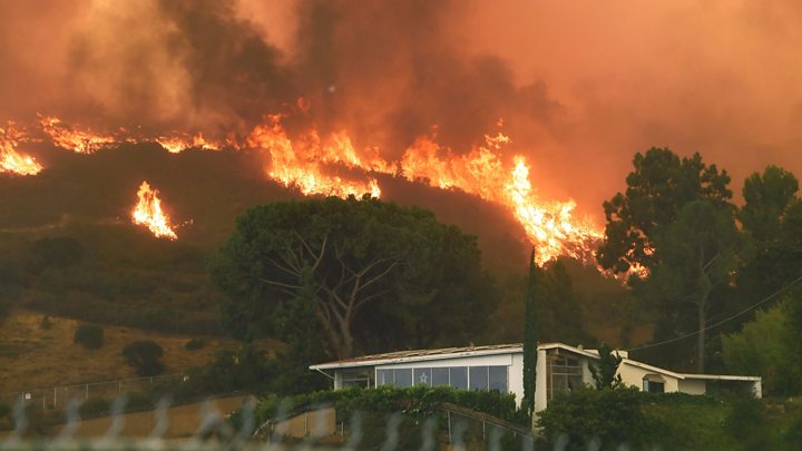
Heatwaves will increase risk of drought and fires
The heatwave can also increase the risk of drought and fires in the area.
The authorities posted red-flag warnings for wildfire danger from the Four Corners region through interior Oregon. More alerts will be issued in the following days.
"Dry thunderstorms" or lightning-producing thunderstorms with little to no rain are also possible, with a greater chance of igniting new blazes.
As of June 23, Wednesday, large fires were active in 11 states. The National Interagency Fire Center reported that in 2021 alone, over 29,000 fires, the most in a decade, burned more than 1.1 million acres.
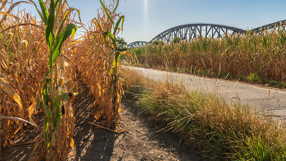
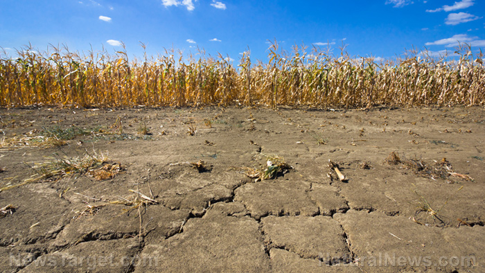
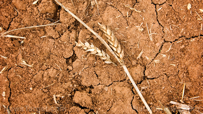
Ongoing extreme to exceptional drought in the West is also slated to get worse. The upcoming heatwave will further dry soils and reinforce drought conditions.
The drought can then make future extreme heat events more likely, which is bad news for farmers in the area. Additionally, fuel models suggest record dryness this early in the season, making wildfires a concern. (Related: Heat waves, drought strain electrical grids and fuel wildfires in US West.)
Over 55 percent of the West is experiencing an extreme or exceptional drought, the two most severe categories, while insufficient precipitation and above-average temperatures spell trouble for agriculture and water resources.
Experts also anticipate hot and dry conditions for the rest of the summer.
Heatwaves in the west keep breaking records
The upcoming heatwave follows a historic heatwave that set over 4,000 records in the West last week. Phoenix hit at least 115 F for a record six days in a row while Tucson reached 110 F for a record eight straight days.
The heatwave even reached Mexico, where a location just south of the U.S. border reached a scorching 124.5 F, the highest temperature ever recorded in the country in June.
Even after the worst of the heatwave abates by the middle of next week, temperatures in the Pacific Northwest are slated to remain warmer than normal and computer models project above-average temperatures through the Fourth of July weekend.
Scientists warn that those in the American West can expect more of the same in the coming years. Park Williams, a University of California, Los Angeles climate and fire scientist, has calculated that soil in the western half of the nation is the driest it has been since 1895.
Williams warned that heatwaves are getting worse in the West because the soil is too dry due to the region's "megadrought." He concluded that there might be two to five more heatwaves "before the end of the summer."
Sources include:


Please contact us for more information.

